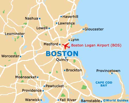
Boston Logan International Airport (BOS)
Orientation and Maps
(Boston, Massachusetts (MA), USA)
A city of culture, shopping and food, Boston is perhaps best known for its vast harbor and impressive skyline, which features many high-rise structures. Boston is particularly attractive at night time, when the buildings are illuminated and reflect in the waterfront.
Logan International Airport (BOS) is surrounded by Boston Harbor and linked to the city via the Ted Williams Tunnel (I-90). Free shuttle buses link the airport with the subway station, and water taxis between the airport and nearby Rowes Wharf are also available.
The main bus station stands along Atlantic Avenue and is known as South Station. The Amtrak train station is located nearby and features regular trains to New York and other prominent cities. Around the city, the MBTA (Massachusetts Bay Transportation Authority) subway trains, often referred to as the 'T', connect many places of interest and are a particularly inexpensive way to travel around.
Boston Logan International Airport (BOS) Maps: Important City Districts
Boston is an extremely walkable city and many of the most popular attractions extend outwards from the Boston Common. The MBTA's Park Street subway station stands to the northeast and the Common Visitors Information Centre is located close to West Street and Tremont Street.
The city's famous Freedom Trail is the perfect way to tour the city on foot, passing a number of major landmarks along the way, including the State House, Bunker Hill Monument and the USS Constitution. The Boston Duck Tours are equally popular, with bright yellow amphibious vehicles that travel around both the city and the harbor.
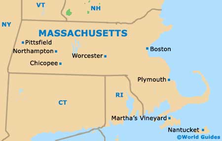
Many people staying in the city of Boston choose to visit nearby Cambridge, which is situated around 5 miles / 8 km to the west of the Common. Havard Square is particularly appealing here, close to the famous Havard University.
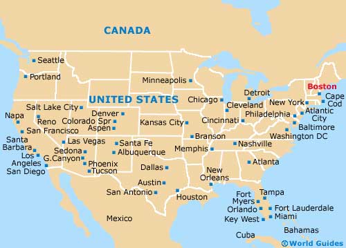
USA Map
Massachusetts Map
Boston Map